
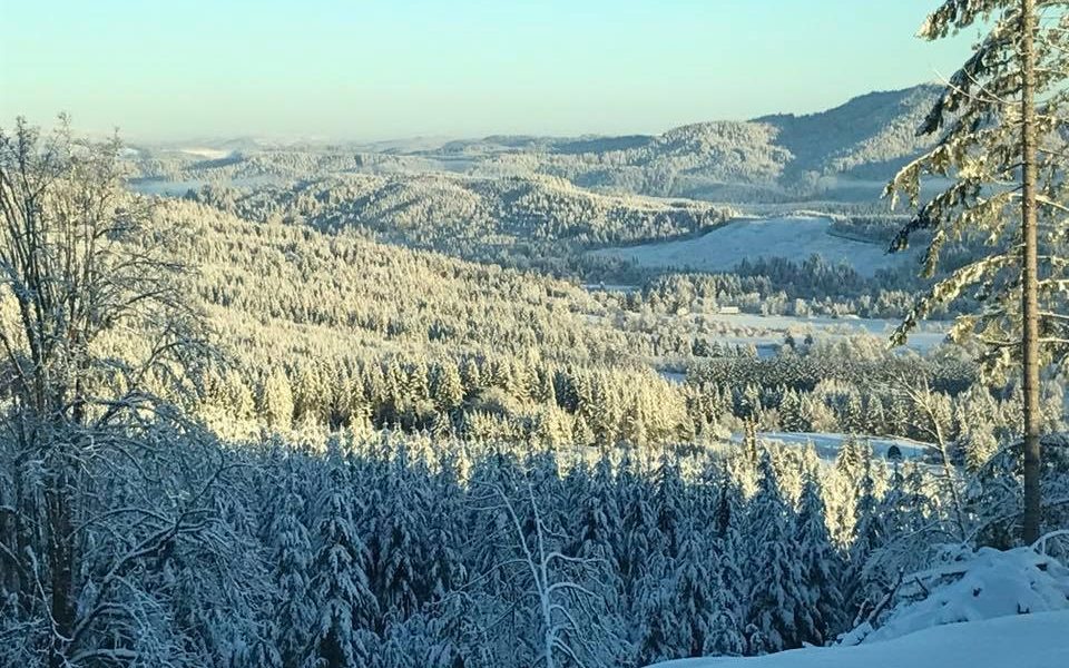
 Snowfall in Gales Creek’s portion of the Oregon Coast Range. Photo by Josh Doss
NW OREGON – The Portland branch of the National Weather Service issued a Special Weather Statement on Wednesday afternoon predicting snowfall at lower elevations in NW Oregon on Thursday evening and Friday morning (February 7 – 8), extending into the weekend and potentially though next week.
The agency said that for many low-elevation locations, little accumulation of snowfall is expected. However, a steadier snow band could develop Thursday night which could result in a “dusting to up to one inch of snow on the ground by Friday morning,” according to the statement.
At this point, temperatures could be cold enough for snow to stick to paved surfaces, leading to a slick Friday morning commute.
As Friday progresses, snow levels are expected to rise, with precipitation falling as rain at 1000′ and below, but this will leave the Coast Range summit at Highways 6 and 26, as well as the community of Timber, still seeing snowfall as a heavier weather pattern is expected to move in.
“Snow levels will be lowering again by early Saturday morning and will potentially be hovering between sea level and 1000 feet through much of Saturday and Saturday night,” Portland NWS said.
As it stands, the agency says much is still unknown about what to expect on Thursday and Friday and beyond.
“At this time, we advise checking the forecast frequently over the next couple of days as details come into better focus.”
Read the full Special Weather Statement here.

Chas Hundley is the editor of the Banks Post and sister news publications the Gales Creek Journal and the Salmonberry Magazine. He grew up in Gales Creek and has a cat.