


Between snow levels rising and rain falling in the forecast, “expect rising river levels, with potential of some flooding,” starting Thursday morning, the Portland office of the National Weather Service said in a Flood Watch issued Tuesday afternoon.
“A Flood Watch is issued when conditions are favorable for flooding. It does not mean flooding will occur, but it is possible,” the National Weather Service said separately.
When flooding is imminent or actually occurring, the agency issues a Flood Warning
While much of the snow in lower areas such as the city of Banks and the lower elevations of Gales Creek is gone, not so for areas in Timber and in the coast range.
There, snow clinging to the hills is expected to begin to melt as heavy rains move in, triggering the National Weather Service to issue a Flood Watch that begins early Thursday, January 6 beginning at 4 a.m. and extending to 6 p.m. Friday, January 7.
“You should monitor later forecasts and be alert for possible Flood Warnings,” the weather agency advised. “Those living in areas prone to flooding should be prepared to take action should flooding develop.”
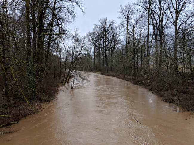
The NWS said that their main concern was rivers draining the coast range—rivers such as the Tualatin, Nehalem and Wilson Rivers—and rivers draining Washington’s Willapa Hills.
Flooding is also possible for the rivers draining Oregon’s Cascade Range.
Or to put it as the flood watch reads, “Excessive runoff may result in flooding of rivers, creeks, streams, and other low-lying and flood-prone locations. Creeks and streams may rise out of their banks.”
 We rely on subscribers to keep the lights on in our little newsroom. Join us with a digital subscription today, $15 off right now for your first year, or $8/a month. Click here to subscribe.
Flooding has already prompted the closure of the infamous flood gates on Fern Hill Road on Forest Grove’s southern edge.
There, the Tualatin River engulfs Fern Hill Road frequently enough during flooding periods that Washington County Land Use and Transportation installed flood gates south of Taylor Way and north of Geiger Road in 2017.
That road closure and others can be found listed on the county’s emergency road closure website, wc-roads.com.
“We know it annoys everyone, but this is done to protect the public and emergency responders,” Forest Grove Fire & Rescue said in a social media post Tuesday. “We don’t know when it will open, this is handled by County LUT and we are just letting everyone know of the closure.”
Information for state highway road closures can be found at tripcheck.com.
Flooding has already hit Tillamook, which saw one incident where the Tillamook County Sheriff’s Office evaluated the Tillamook Coast RV Park for a possible evacuation Monday, December 3.
“It was reported that water had breached the banks along the waterway commonly known as the Ditch that runs between the Trask and Tillamook rivers,” the Tillamook County Sheriff’s Office said in a press release.
After assessing the situation with the property owner, two county deputies, aided by a Tillamook County Public Works employee, plugged a hole in the breached bank with traction sandbags.
“This situation will continue to be monitored and an evacuation plan is in place if needed,” the sheriff’s office said, noting that flooding was occurring “in the usual spots on our roads.”

Chas Hundley is the editor of the Banks Post and sister news publications the Gales Creek Journal and the Salmonberry Magazine. He grew up in Gales Creek and has a cat.